

Geospatial Solutions
Geospatial solutions are the compass that guides businesses towards intelligent decision-making, unlocking the power of location data to drive innovation and efficiency

Discover How to Unlock the Value of Your Geospatial Data
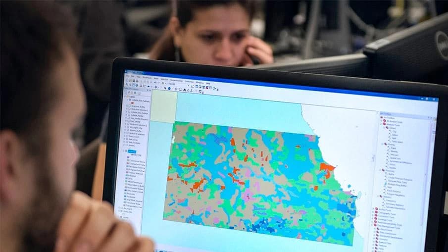
Our Geospatial solutions and services are means to translate GIS data into valuable information. Having access to accurate and relevant information at the right time contributes to effective decision making that drives client success.
Our Capabilities
Geospatial Data Modelling
GIS data modeling is crucial for effective GIS database design and management. It helps ensure data consistency, accuracy, interoperability, and scalability across various GIS applications and platforms. By creating a well-designed data model, users can efficiently store large volumes of geospatial information while enabling complex analysis tasks like querying, buffering, network analysis, or overlay operations.
Remote Sensing
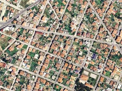
We believe remote sensing is a fundamental key to solve many social, economic, and environmental problems in our community. The remote sensing team utilizes various remote sensing data such as Visible/Near Infrared, Shortwave Infrared, Thermal, Lidar, Radar, and Nighttime data to fix problems, monitoring, and predict necessary information for different industries.
BIM / CAD
We offer 2D-CAD to 3D-BIM data conversion services. Coordinated models created with BIM enable our clients to analyze potential conflicts between all building systems. Clash Detection can be performed virtually, saving money on labor and material in the field. We collaborate with construction companies and general contractors to automate their BIM processes, resulting in optimized design and construction management processes that include details about project phasing, scheduling, and costing.
Data Conversion/Migration
With the perfect tools for data processing, migration & conversion, Our data experts help you smoothly migrate binary and convert papers, documents, spreadsheets, CAD files or any form of data to GIS ready data.
Mapping
We produce a wide range of ISO-compliant digital maps with different scales and types. Production Cycle includes data acquisition, collection of ground control points, digitization, surveying, data collection, data entry, quality control and data cartographic visualization.
Geospatial Solutions & Enablement
We have many years of experience helping businesses achieve their goals through custom software solutions based on a deep understanding of their unique processes, challenges, and needs. In recent years, custom software solutions have deservedly increased their market share because of the incredible value they bring to users. Read on to learn why a custom solution may be a good fit for your business.
Geospatial Intelligence
We offer collection, analysis, and visualization of geospatial data to support decision-making in a wide range of applications. The benefits of geospatial intelligence include improved understanding of complex systems and processes, improved efficiency and reduced costs, improved safety and security, and the ability to make informed decisions about resource allocation, planning, and management
Geospatial Portals
We provide access to geospatial data, tools, and services. Geospatial portals can include a wide range of features and functionalities, such as search capabilities, data visualization tools, geospatial analysis tools, and collaboration features. By providing users with access to a wide range of geospatial resources, geospatial portals can help to improve efficiency, reduce costs, and facilitate collaboration among stakeholders.
How Geospatial Solutions Can Help Various Industry Sectors
GIS is expanding far beyond the traditional, spurred on by technological advances that provide easier real-time access to a bounty of geospatial data. Using GIS in business has become mainstream and it’s now easy to find widespread GIS adoption in every business sector
A Vision for a Sustainable, Geo-Intelligent Digital Transformation
The market leader in Geo-Intelligent solutions with innovative ideas based on the latest technologies

Data Experts provide professional consultation services that are intended to help organizations utilizing the geospatial aspects of their data and location centered analytics to improve their decision making processes and optimize their daily operations. Data Quality Control/ Quality Assurance, Field Quality Control/ Quality Assurance,Data management workflow organization, Data Production Standardization, Project Planning and coordination
Believing that trusted data is the key to digital transformation, our data experts set the foundations of the data as an asset to make it meaningful and business-driven with the target of making progress toward business goals. Our Data Services include data collection, conversion and creation from our supply of up-to-date mapping to the integration of map-based information with database records.
Project Management as a Service (often shortened to PMaaS) is an adaptable consulting service that allows clients to hire as many project managers as needed to see their projects through. The value of PMaaS is that clients can scale the amount of consultants up and down to fit their needs.
Collaborating With The Best!
We pride ourselves on the rewarding confidence our renowned clients have put in us over the years, appreciating with immense gratitude the deep and fruitful relationships that have resulted in achieving a prolific mutual value.





























We have all the know-how. Learn more from our Case Studies
With our dedication to innovation and excellence, Our experienced team of professionals is committed to working closely with our clients to overcome challenges and introduce efficiencies









Vertiv Appoints ALKAN Construction and Communication Networks as Diamond Partner in Egypt
Vertiv, the global leader in critical digital infrastructure and continuity solutions, has appointed ALKAN Construction and Communication Networks as a Diamond Partner in Egypt. With a proven history of delivering advanced infrastructure solutions across the Middle East and Africa, ALKAN’s significant local expertise and market influence are pivotal in Vertiv’s expansion within Egypt’s rapidly growing ICT sector. ALKAN's partnership with Vertiv will allow it to offer more advanced and scalable solutions and enhanced services, boosting its ability to meet the evolving digital demands of Egypt’s ICT sector.